thinkWhere Consultant Charles Thompson talks about achieving his MSc in Geographical Information Systems through UNIGIS UK. UNIGIS UK is a partnership between Manchester Metropolitan University and the University of Salford. They provide distance learning-based postgraduate education and training in Geographical Information Systems and Science.

“I began studying for an MSc in Geographic Information Systems after working in a GIS role for a few years, and I decided I wanted to expand my knowledge of GIS and range of skills, while also adding a postgraduate qualification to my CV.
After researching a range of distance learning courses, I landed on UNIGIS, which is a GIS programme specifically designed for distance learning. The UNIGIS programme is run from universities all over the world, 2 of them being in the UK, Manchester Metropolitan University and University of Salford.

I was admitted into Manchester Metropolitan University who at the time, offered 3 different GIS MSc pathways:
- GIS Technology
- Applied GIS
- Geographic Information Systems
I thought it was best to study both applied and technological aspects of GIS, rather than focus on one, so I chose the Geographic Information Systems pathway. All these courses would run over a period of 3 years on a part-time basis, where students were expected to put in approximately 15 hours studying per week. I knew this would be challenging while working full-time, but I also envisaged the benefit of studying while working, so I could apply new ideas and skills directly into the workplace.
The 3 year course was split into individual units, where each unit delivered material for a particular GIS topic:
1st year
- Foundations of Geographical Information Systems
- Spatial Data Infrastructures
- Databases
2nd year
- Methods in GIS
- Social Applications in GIS
- Spatial Databases and Programming
3rd year
- MSc Project & Dissertation
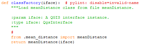
I personally found the 2nd year of study the most rewarding, as I focused on programming and spatial databases. Throughout the majority of my professional experience I had focused on using Desktop GIS software, such as QGIS, whereas this unit allowed me to build my own spatial database using PostgreSQL and PostGIS, while also developing a QGIS plugin using Python.
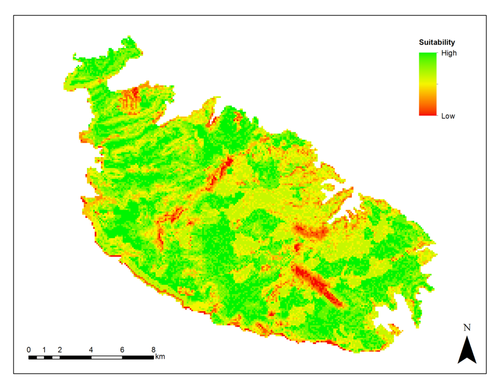
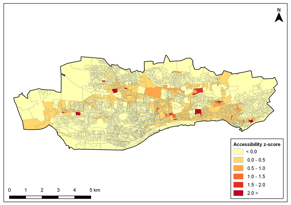
My final year of study was to complete a dissertation on a topic of my choosing. I chose to assess spatio-temporal accessibility to sport facilities in urban areas of Scotland. This involved using Python to collect data from a routing API, followed by processing, analysing and presenting the data using PostgreSQL and QGIS.
I successfully graduated in October 2019 and was awarded a distinction, while I was also awarded dissertation prize of the year for 2018-19.
Completing the MSc has definitely increased my GIS knowledge and improved my technical GIS skills, while I have also learned to manage my time as effectively as possible. I would certainly recommend the UNIGIS courses to anyone wanting to study GIS while working, despite the challenges of balancing full-time work and part-time study.”